Points of Interest
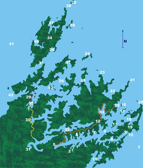
QUEEN CHARLOTTE SOUND AND TORY CHANNEL
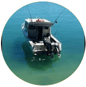
1. Compass Charters Base. Waikawa Marina. Approximately 5 minutes drive from Picton
2. Picton township. The Interislander ferries between the North and South Islands berth here bringing passengers, vehicles, freight and on the Interislander, railway wagons. Population is approximately 4000. The township has a full supermarket and a smaller superette, 2 banks, plus an array of tourist shops. The nearest large town is Blenheim with approx. 30000 people, home of the world famous Marlborough Sauvignon Blanc wine.
3. Cook Strait. The body of water between the North and South Islands connecting the Tasman Sea to the West with the South Pacific Ocean to the East. It is approx. 22 kms wide at its narrowest point with the Interisland ferries taking approximately 3 1/2 hours to cross between Picton and Wellington.
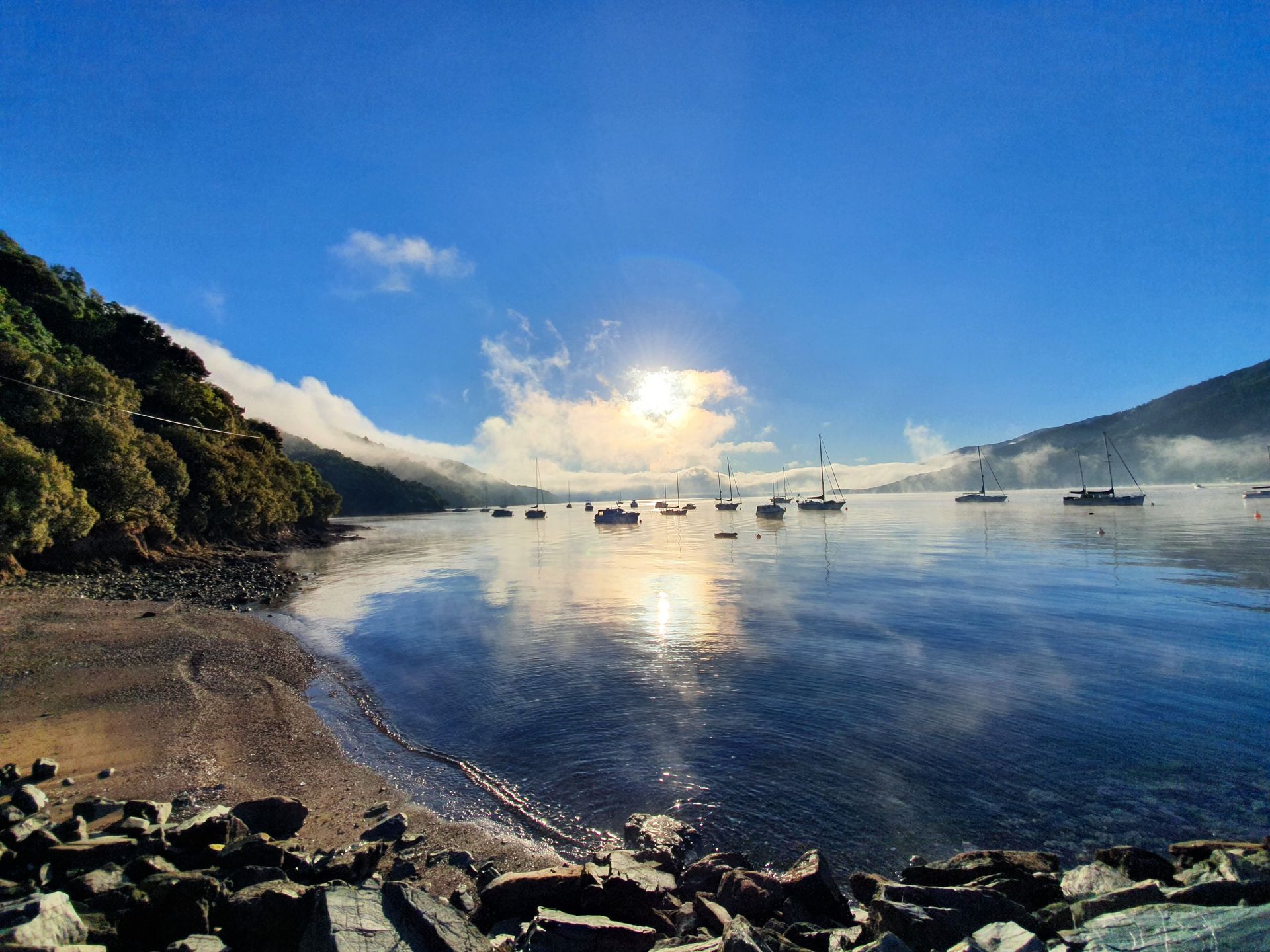
4. Queen Charlotte Sound. Named for the wife of King George the Third by Captain James Cook who visited during each of his 3 voyages to NZ. It was formed by the last ice age and is a drowned river valley.
5. Anakiwa.
The starting point for the world famous Queen Charlotte Track, Anakiwa has a number of permanent residents (approx. 50) and some holiday Baches. The Outward Bound School was established at Anakiwa in 1962 and offers courses designed to challenge mentally, physically and emotionally.
6. Torea Bay. Torea offers road access over the hill to the Portage Resort. It's takes about 10-15 minutes to walk "over the hill" to the iconic Sounds resort at the head of the Kenepuru Sound.
7. Ruakaka Bay. The deep clear water with excellent tidal flush make Ruakaka Bay ideal for the New Zealand King Salmon farm based here. Staff are always on site but no "door" sales are permitted. You can circumnavigate the farm however take care to avoid the anchor points and service vessels. You will see abundant seals and birds attracted by the idea of an easy meal, drop a line and try your own luck for a blue cod or use a spinning lure for a kahawhai. Further inside the bay you will see some well established holidays homes and the Department of Conservation camp site at Ratimera is very popular with runabouts in summer.
8. Tory Channel. The Interisland ferries enter Tory Channel from the infamous Cook Strait. Tory Channel is less scenic than the larger Queen Charlotte Sound and care must be taken to stay well out of the way of the ferries which travel through 24 hours a day. There are a number of mussel farms in the more sheltered spots and a Salmon farm at Te Pangu and Clay Point.
9. Te Awaiti Bay. The entrance to Tory channel provided a sheltered spot for the whalers of the 19th century and the remains of the whaling station at Te Awaiti Bay have been partially restored by Dept of Conservation. The wharf and slipway remain with the skeleton of the old processing plant. The National Whale Centre in Picton is a tribute to this rich history that also gave rise to a thriving timber boat building industry.
10. East / West Head. Tory Channel entrance. This narrow gap is very tidal and confused. It is a controlled navigation area and our charter vessels may not exit out into Cook Strait at any time. And may not enter the Controlled Navigation Zone.
11. Port Underwood. Drive only access for runabouts. You can drive in from Waikawa or from Rarangi with the road largely unsealed. Care must be taken as large log trucks frequently use the road. Runabouts are restricted inside a straight line from Robertson Point to the south point of Ocean Bay.
12. Queen Charlotte Track.
70 km from Anakiwa to Ship Cove open to walkers and cyclists (some restricted areas require a paid track pass) the track usually takes 4 days however there are some day walks ideal for charterers. Get the skipper to drop you off and arrange the pick up point (take a cell phone however cover is limited in some spots)
Mistletoe Bay to Anakiwa 4 hours 12.5 km
Torea Bay to Mistletoe Bay, 2 1/2 hours 8km
Endeavour Inlet to Punga Cove 4 hours 11km
Resolution Bay to Endeavour Inlet 3 hours 10km
Ship Cove to Resolution Bay 2 hours, 4km
13. Blumine Island.
The site of 2 gun emplacements built during World War II to provide a secure anchorage for the US Navy. The remains of the wharf can be seen on the NW side of the island and a road links the two sites with the remnants of the magazine and gun emplacement site can still be seen. The track between the first and second site (approx. 20 minutes) is an interesting walk. With Blumine Island predator free bird life is tame and vocal
14. Endeavour Inlet. A natural destination for many with the historic Furneaux Lodge and relaxed Punga Cove high on the list for many charterers. Furneaux Lodge was built in the early 1900's and is set on 2000 acres of native virgin bush. Punga Cove offers waters edge café style meals in the Boat Shed Café and Bar or more refined dining up the hill at the Punga Fern Restaurant.
15. Ship Cove. The start of the Queen Charlotte Track there is a substantial jetty and toilets ashore. There is a shorter walk (1/2 hour) to the waterfall at the head of the Bay. The Cove was named by Captain James Cook and 1770 when his ship the Endeavour anchored to replenish food, water and wood. An impressive monument provides a great photo op.
16. Motuara Island. Administered by Department of Conservation Motuara Island is predator free and regular tourist vessels land parties here at the jetty. The well maintained track leads up to a viewing platform offering uninterrupted views of Cook Strait. The island is home to a variety of native bird life, insects and lizards. The inquisitive south island robin will forage in your footsteps with fantail, the bell bird is evident with its distinctive call but you may also be fortunate enough to see or hear the endangered saddle back and kakariki. This is also a nursery for young Okarito brown kiwi chicks. The Maud Island frog and Marlborough green gecko also enjoy the safe haven. Blue penguins come home to roost each evening and some viewing nest boxes have been setup where you can take a peak.
17. Long Island. A mecca for diving and snorkeling this reserve was set up in 1993. The island is predator free and virtually inaccessible with very limited landing spots (a great natural defense)Underwater the reef system are is home to sea urchins (kina), abalone (paua), rock lobster (crayfish) and a healthy fish population including blue cod, perch, tarakihi and gurnard. Kelp beds support butterfish and moki.
18. East Bay. A well known spot for scallops in season, East Bay boosts large numbers and large scallops. NZ King Salmon have an established farm at Otanerau and there are a number of mussel farms in East Bay.
19. Arapawa Island. With Queen Charlotte Sound to the west and Tory Channel to the East, Arapawa Island is home to rare breeds of pigs, goats and sheep that are thought to be old English breeds introduced by early whalers. Department of Conservation have put considerable work in to poisoning the wilding pines to allow for native bush regeneration.
20. Cape Koamaru. The north eastern tip of Queen Charlotte Sound known as the "northern entrance".
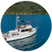
FOR OUR LARGER YACHTS (39ft+)
on
7 day or longer charters. Weather/conditions permitting you can head to the Outer Sounds and Pelorus Sound. And even Abel Tasman for the adventurous. Please let us know PRIOR to you arrival, if you are hoping to go around the corner.
21. Cape Jackson. The north western tip of Queen Charlotte Sound known for its extremely tidal passage way between the mainland and the outlying rock and lighthouse. Infamous site of the foundering of the Russian cruise liner, Mikhail Lermontov in 1986, which stuck rocks and subsequently sank in Port Gore with the loss of 1 life. Wrecks of the Lastingham (1876) and Rangitoto (1869) are also popular with divers.
22. Port Gore.
A large exposed bay with an interesting ship wreck history including the Russian cruise liner Mikhail Lermontov. A dive complicated by the depth and water clarity suitable only for experienced divers in ideal conditions.
23. Alligator Head. The bay tucked in behind the Alligator head is known as the 'punt rails' offers a welcome safe sheltered anchorage spot on the long haul across to or from D'Urville Island or Pelorus Sound.
24. Chetwode Islands. This group of islands is a wildlife sanctuary and landing ashore is strictly prohibited.
25. Allen Strait. This separates Forysth Island from the mainland and is about 350m wide. Safe to navigate in good conditions this cuts hours off the trip in to Pelorus.
26. Pelorus Sound.
The largest of the sounds which make up the Marlborough Sounds, Pelorus' shoreline runs for approx. 380 km. It was formed after the last ice age and is a system of drowned river valleys with Havelock the largest settlement at the apex. The sheltered waters with greater silt build up than Queen Charlotte is ideal for mussel farming.
27. Port Ligar. The last shelter from the swell in Cook Strait this is an ideal spot to head for or take off from when traveling between Queen Charlotte and D'Urville or Pelorus.
28. Worlds End / Penzance. Tennyson Inlet, a scenic reserve which hides two of the most beautiful secluded spots in all of the Sounds.
29. Archers Track. A scenic coastal walk from Elaine Bay to Penzance. approx. 3 1/2 hours easy walk.
30. Nydia Bay Track. A 2 day track from Duncan Bay to Kaiuma the Nydia Bay campsite is the natural 1/2 way point to camp for the night. For the adventurous the climb from Nydia Bay offers great photo opportunity of Tennyson Inlet from the top of the saddle. The shore line walk between around Nydia Bay is considerably easier, 1 1/2 hours through regenerating native bush.
31. Havelock. The "mussel capital of the world". Sanford's have a processing factory for the green lipped mussel that are "farmed" within the sheltered waters of the Marlborough Sounds. The birthplace (and early schooling) of world famous scientists, Ernest Rutherford (The pioneer of modern atomic physics) and William Pickering (pioneering jet propulsion engineer instrumental in the NASA early space missions)
32. Kenepuru Sound.
Portage Resort and Raetiti Lodge are both tucked away in the shelter of Kenepuru and both have rich "Sounds" history. Portage is an easy walk "over the hill" from Torea Bay and Raetihi has moorings available.
33. French Pass / Te Aumiti. The narrow stretch of water (100 m at its narrowest) between the mainland and D'Urville Island is notorious for the tidal currents that run at 8 knots, creating whirlpools and eddies. A truly awesome passage which can be viewed from above on the mainland. History tells of "Pelorus Jack" a Risso's dolphin who first appeared in 1888 and escorted ships to French Pass from the Elmslie Bay area frequently over the next 24 years.
34. D'Urville Island. Named for Admiral Jules Dumont D'Urville, he was made the first recorded European navigation of French Pass in the "Astrolabe" in 1827. It was not without incident and she lost steerage and was swept through by the turbulent current, striking the reef at least twice. D'Urville Island has a small resident population (approx. 50) and is NZ 5th largest island.
35. Catherine Cove. The hospitality of the D'Urville Island Resort at Catherine Cove is legendary. Their café and bar are welcoming and their moorings secure making this a "must stop" for those that venture this far off the beaten track.
36. Rangitoto Islands.
This group of 3 small islands is off the northern tip of D'Urville.
37. Port Hardy. A large bay on the western side of D'Urville Island
38. Stephens Passage.
The Stephens Island lighthouse has operated since 1894
39. Stephens Island. A nature reserve with access severely restricted, this is home to NZ's living dinosaur the Tuatara. With a population of approx. 30000 they share the island with Hamilton's frog another endangered native.
40. Greville Harbour. A large bay on the western side of d'Urville Island. Open to the west
41. Tasman Bay and Golden Bay, the western top of the South Island.
Abel Tasman National Park has magnificent golden beaches. Nelson is the oldest city in the south island and has a population of approx. 46,000. Its Harbour is protected by the naturally formed 13 km "boulder bank"
42. Croisilles Harbour.
This large sheltered bay is a natural stopping point before entering the "current basin" of tides affected by French Pass. Okiwi Bay has a settlement of holiday homes and a camp ground offering easy access to the excellent fishing grounds of D'Urville and the exposed coast.
43. Maud Island.
A restricted access reserve which is home to NZ takahe and kakapo recovery programme and the only managed population of Maud Island frog, a unique native.
Related Pages:
Feedback
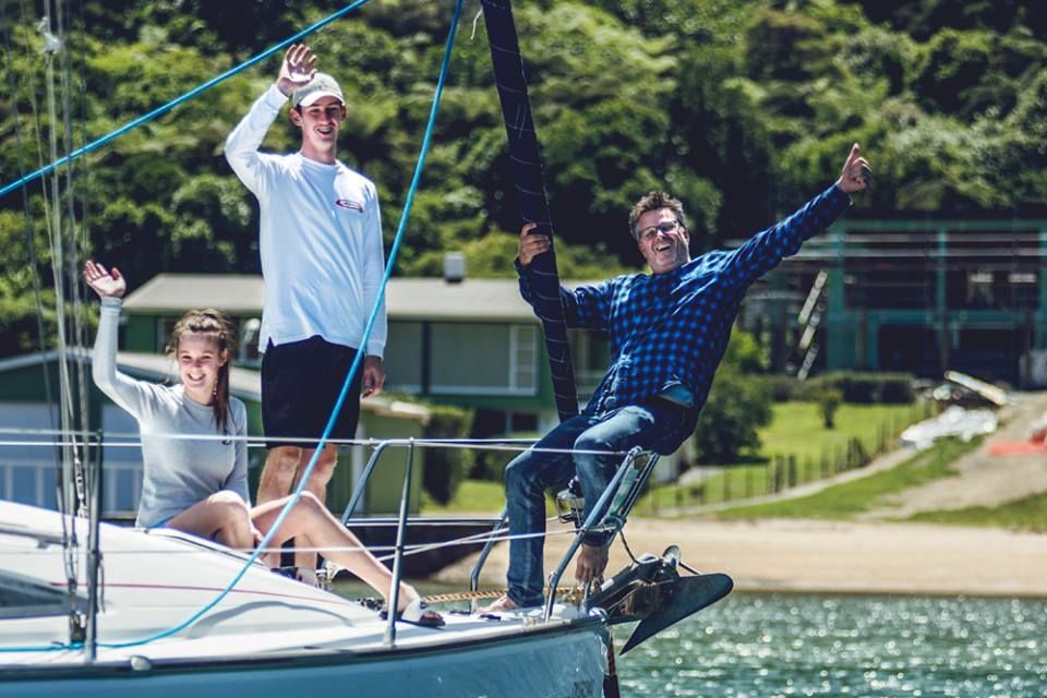
Here's what our clients have been saying about us.
"Thanks to you and the Compass Charter team for the great day we had in the amazing beautiful Marlborough Sounds. Would love to come back within 12 months although not sure if I will be able to manage that. For sure I will connect again when ever I will be in New Zealand."
Chartered Orion
"Thank you very much, we really enjoyed our trip and are telling our friends and family that Compass Charters are a good company to deal with and offer great holiday opportunities."
Chartered Okoromai
"Just to let you know that we had an awesome few days on ZH. The boat was clean & today & had everything we needed, the Sounds were gorgeous, and the service from Compass Charters was great.
Thanks". Chartered Zachary Hicks
"Thank you! We had a wonderful time and are already planning a return visit!". Chartered Bugamar
CONTACT US NOW spaces are ALREADY filling up for the NEXT SEASON!
Special Offers
BOOK A LONG WEEKEND CHARTER THIS MAY AND GET 10% OFF the daily rate!
We still have availability so
ENQUIRE NOW
TO SECURE YOUR
LAST CHANCE TO GET ON THE WATER THIS SEASON!
QUOTE PROMO CODE: MAY 24
Offer expires on 27 MAY 24
TERMS: Full payment at the time of booking/Non-refundable.
EARLY BOOKING DISCOUNT for next SEASON 2024/2025
Book 6 MONTHS before your charter and get 5% off your daily rate.
(can be used in conjunction with other relevant discounts - TERMS APPLY)
To view our
SAVE - SAVE - SAVE - SAVE - SAVE - SAVE